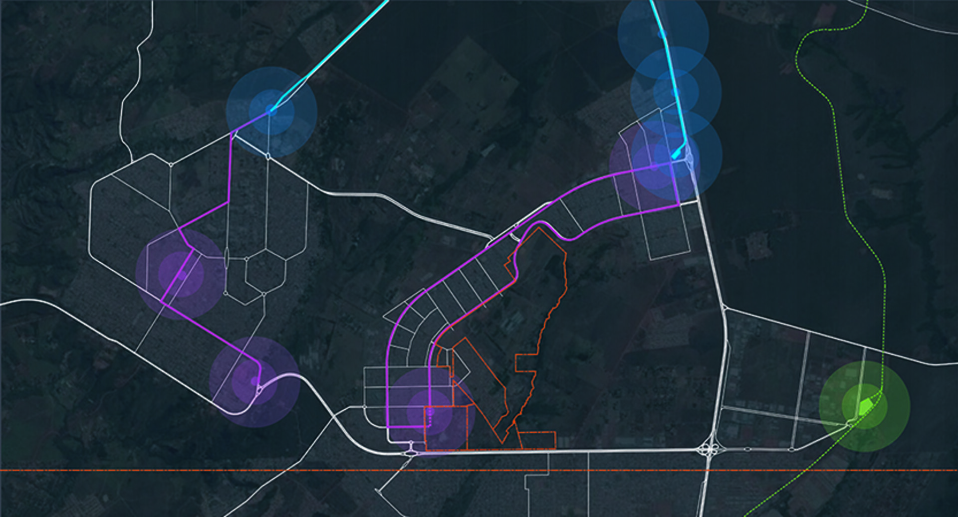
In 2017, CONDE Urban Design was invited to validate/review the Urban Guidelines and develop a Master Plan for an area of approximately 440 ha part of the remainder of Quinhão 23 of Fazenda Santa Maria, in the Administrative Region of Santa Maria, in Federal District.
These guidelines, developed by SEDHAB to promote the orderly occupation of the territory, aim to guide the Government and private entrepreneurs in the use and occupation, and are valid for 4 years, expiring in early 2018, opening the opportunity for revision accordingly with the objectives outlined for the future Enterprise, object of the Masterplan to be developed, laying the foundations for decision-making during the consolidation of the limits of the Plan’s area.
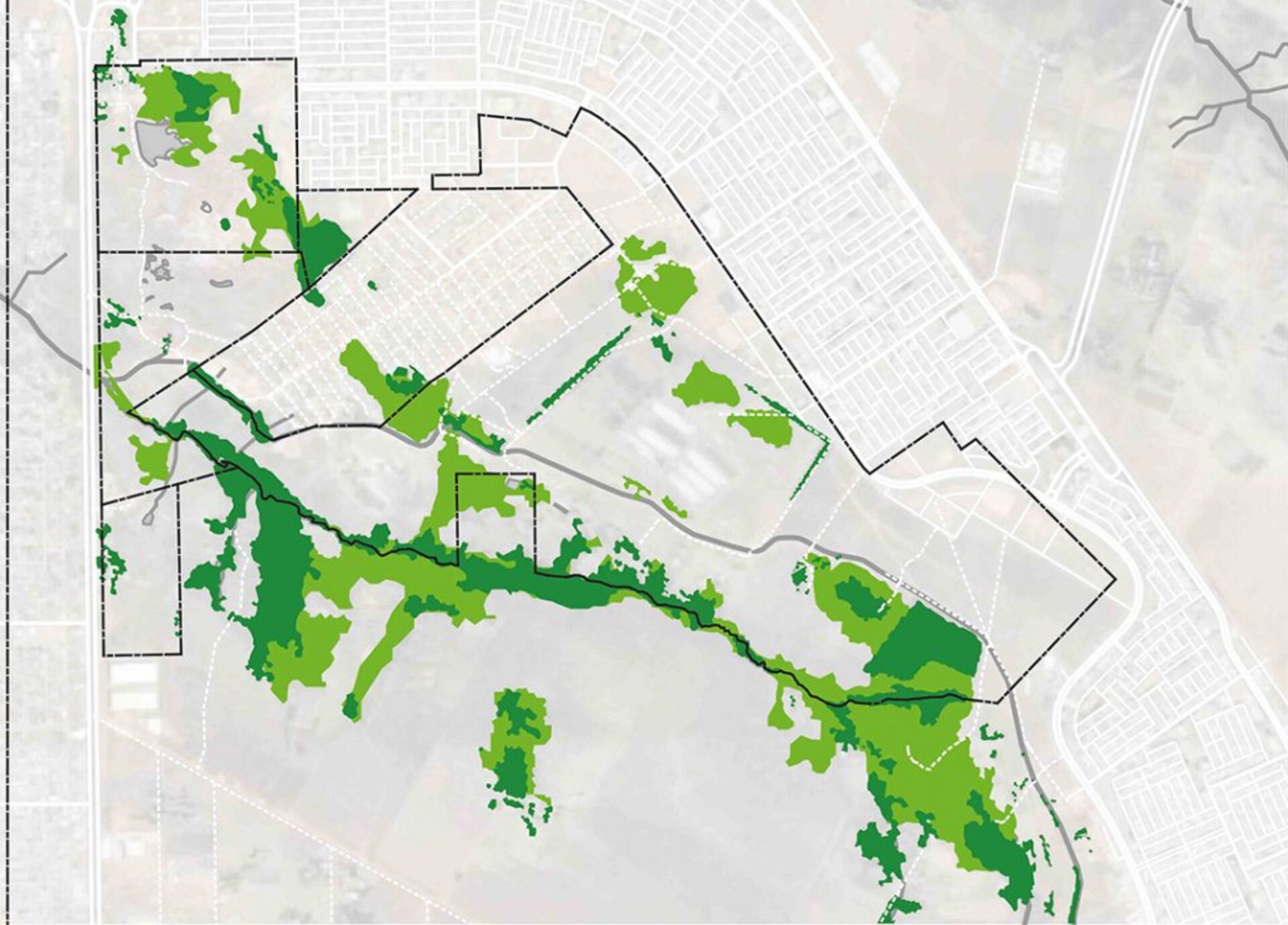
The Master Plan for the area will be an important urban planning instrument that aims to reorganize the occupation of the land, promoting the articulation of its different portions and the improvement of urban quality and the collective well-being of future residents, workers and visitors to the Enterprise. The challenge will be to plan a community with 25,000 units, which has the key elements of attraction for development and quality of life, together with the responsible use of environmental resources and the integration of social groups in the region.
Goals
Faced with this challenge, Conde Design is committed to exploring alternatives to the current “sleeping city” approach clearly established for Santa Maria, seeking a complete, compact and vital community, environmentally sustainable, connected to its surroundings and focused on economic activities important for its future as a city. Thus, we adopted the following objectives for this work:
Attract new or complementary economic activities to those in the surroundings, which generate employment and income for the population of Santa Maria
- Structuring and articulating the urban fabric in order to integrate and connect existing locations, and apply the set of urban policy instruments suitable for land qualification, occupation and regularization
- Qualify the occupied areas to reverse environmental damage and recover degraded areas
- Constitute areas to meet the demands of the community
- Pre-plan the environmental sanitation infrastructure for the occupation, considering the watershed’s socio-environmental support capacity

Reference Material
The survey of current conditions and development guidelines for the Expansion of Santa Maria and its surroundings, presented here, were defined based on the following documents.
- Master Plan for Territorial Planning of the Federal District – PDOT – Technical Document, Secretary of State for Urban Development and Environment of the DF, 2017
- Urban Guidelines – Expansion of Santa Maria (Ribeirão Housing Sector and adjacent areas), SEAHB/SUPLAN/DIPLU/GETER, February/2014
- Urban Guidelines – Meireles Sector, SEGETH/SUGEST, undated
- Environmental Impact Report – JK 3rd Stage Development Hub, PROGEA, August/2011
- Santa Maria Urban-Environmental Study, Codeplan/DEURA, 2015
Knowing the Cerrado and its paths
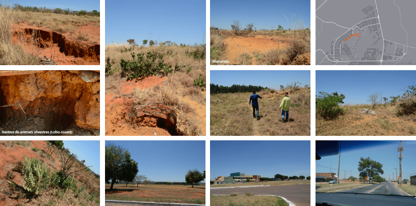
Site Tour
In addition, a visit was carried out on 10/19/2017 to increase understanding of the territory, helping to identify some characteristics of the region.
Region
The site object of this Masterplan is located in the south of the Federal District, in the Center-West region of the country, along the geographic region known as the Central Plateau, more specifically in the Administrative Region of Santa Maria, approximately 30 km south of the Monumental Axis of Brasilia.
The metropolitan area of the Capital is composed of the urban DF and 12 more municipalities in the geographical periphery, created to house people residing in invasions or temporary population centers, a solution found to house the population surplus due to the construction of Brasília, which then emerged , the so-called “satellite cities”.
Planned to have a population of 500 thousand inhabitants in the year 2000, the population of Brasília, with its current 2.977 million inhabitants, places the Capital as the fourth most populous city in Brazil today. As a result of the uncontrolled spatial planning process, the Federal District underwent an intense expansion of urbanization to the bordering periphery, which gave rise to the formation of the metropolitan region of Brasília, currently institutionalized as the Integrated Development Region of the Federal District and Surroundings -RIDE.
